


Half Moon, Galloway Flats Trails Now Open
Half Moon Trail five years in the making open in Eau Claire
Barbara Arnold, photos by Andrea Paulseth |
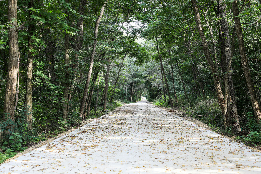
Chippewa Valley bikers, hikers, joggers, runners, and walkers have two new outdoor trails to explore: the Half Moon Trail and the Galloway Flats Trail. The Half Moon Trail, about a half mile long, connects Folsom Street to Madison Street, and will also connect to the Folsom Street-High Bridge Trail. The shorter Galloway Flats Trail connects Eau Claire via an underpass to River Prairie in Altoona. Completion of both trails is expected by the end of summer.
The Half Moon Trail has been five years in the making, according to Cheryl Leonard, vice president of the Upper Westside Neighborhood Association and chair of its Half Moon Trail Committee. Back in 2019, she invited Eau Claire City Council members to walk the proposed trail with her, and Jeremy Gragert, then a City Council member for the Third District and now president of Bike Chippewa Valley, said yes.
“We are very happy with the outcome,” shared Leonard. “Our neighborhood association members had many questions, and the city’s engineering department answered most. We had specific criteria we wanted the city’s engineering department to follow, such as keeping the tree canopy overhead for shade, which meant a curvy rather than a straight path, and meshing with the needs of both homeowners and wildlife in the area. The city’s engineering department was phenomenal.”
“This new trail expands the network of safe walking and biking options for west side residents. ... It's completely ADA-accessible, too.”
clara serrano
eau claire city council
Gragert, a new upper west side homeowner and a longtime commuter bicyclist, agreed. “This trail is a beautiful, natural way to commute from the upper west side to downtown,” he said. “It could be used by professionals (Mayo Clinic and downtown businesses) and children (Roosevelt Elementary School and the Montessori School). Its use is so much more than recreational.”
Clara Serrano, the newly elected City Council representative for the neighborhood, is also pleased. “This new trail expands the network of safe walking and biking options for west side residents,” she said. “The trail has a lush tree canopy that makes you forget you are even in the city, as it meanders through the neighborhoods. It’s completely ADA-accessible, too.”
The trail was primarily paid for via a state grant, and its location was easy to work with, according to Deputy City Engineer Al Rinka. “The final cost to Eau Claire will be only about $120,000, for a project costing roughly $600,000, due to a state grant,” he said. “And because the trail is an old railroad bed at railroad grade, we didn’t have to move any homes or buildings out of the way.”
Meanwhile, two Eau Claire couples recently tried out the Galloway Flats Trail – which goes underneath the River Prairie Bridge, made in collaboration between the Galloway Flats developer and City of Eau Claire – and are singing its praises. Bicyclists Terry and Brent Wells often take the Galloway Trail on Galloway Street to pick up library books, cruise around Carson Park and check out the new Sonnentag Center.
Wells posted on Facebook that they are excited about the new trails, especially Galloway Flats, as they often feel unsafe crossing at the Birch Street intersection. Now, they will safely go on the trail. Colette Couillard and Peter Kaesberg also walked their two dogs on the trail recently. Couillard mentioned that they are so happy to find out that they can now safely get to River Prairie on their bikes as she was almost hit at the intersection above the underpass trail.
Revisions to the Bike Chippewa Valley trail map are forthcoming due to the new trails. In the meantime, check out the map online at bikechippewavalley.com.
