
Hiking Beyond the Valley
grab your boots and bug spray, then hit the road to find these fabulous hiking spots
Last year, I wrote an article for Volume One titled 25 Hiking Trails in the Chippewa Valley, which you can read online at volumeone.org/hiking. For hiking enthusiasts willing to drive a bit outside of the area, here is a select list of our favorite trails within a 90-minute drive. All directions and distance times listed are from Eau Claire. Fees reflect hiking, not other activities such as skiing and biking. For state parks, 2018 state park pass rates are $28 annually if you’ve got Wisconsin license plates ($38 for out-of-state) or daily rates of $8 for Wisconsin plates ($11 out-of-state). Note that some trails are closed to hiking during cross-country skiing season. For maps of these trails, find this article on VolumeOne.org. Trail description definitions: “Easy” means the ground is level; “Moderate” means there are some elevation changes; “Difficult” means there are steep climbs or very uneven terrain underfoot. “Well-groomed” means the path is clearly visible with no tall undergrowth. “Semi-groomed” means there are sections where vegetation has grown over the trail. Widths of trails are also noted.
HEADING NORTH OF THE CHIPPEWA VALLEY
Chippewa Moraine Recreational Area
Where: New Auburn, Chippewa County
Trail descriptions: Moderate. Well-groomed. Trail widths vary. Options include the 0.7-mile Mammoth Trail Loop, the 1.8-mile Dry Lake Trail Loop, and the 4.5-mile Circle Trail Loop. All have several elevation changes and pass by small kettle lakes as well as larger lakes. Be prepared for wet spots by wearing waterproof hiking boots. The Ice Age Trail goes through the park and joins these trails for a short distance.
Highlight: My wife Jayne and I come about once a month and often see beavers and loons. Be sure to visit the David R. Obey Ice Age Interpretative Center.
Fee: None if you park at the center. State park sticker required if you park in the dirt lot on County Road M just west of the center.
Distance/Directions/Parking: 45 minutes. Take U.S. Highway 53 north to the New Auburn exit and then take County Road M east 7 miles to the center, where there is ample parking. See map.
Chippewa Moraine Segment / Ice Age Trail
Where: Chippewa County
Trail descriptions: Moderate. Semi-groomed. Narrow path. This is a gorgeous winding trail with several elevation changes. The entire length is a bit more than 5 miles one way. Prepare for wet spots by wearing waterproof hiking boots. High tick area, so bring repellent.
Highlights: Look for a bench overlooking a small island. We have seen otters play in Horseshoe Lake.
Fee: None.
Distance/Directions/Parking: 45 minutes. See the above directions to the Chippewa Moraine Recreational Area and pick up the trail there by hiking east; or continue driving east on County M, then turn right on Ice Age Drive and go about one-third of a mile to the two-car parking spot on the right and hike east; or drive further on County Road M to Plummer Lake Road, turn right and drive for 1 mile to the boat landing where there is room for a few cars, and hike west. See map.
Harwood Lakes Segment / Ice Age Trail
Where: Chippewa County
Trail descriptions: Moderate. Semi-groomed. Narrow path. This segment of the Ice Age Trail continues east from the Chippewa Moraine Segment. More gorgeous scenery accompanies the winding path with lots of elevation changes. The trail is approximately 5 miles one way. Prepare for wet spots by wearing waterproof hiking boots. High tick area, so bring repellent.
Highlights: The trail crosses a large beaver dam by Harwood Lakes. We also came across a heron rookery east of Deer Fly Trail.
Fee: None.
Distance/Directions/Parking: 55 minutes. See the above directions to the Plummer Lake boat landing and hike east from there; or from County Road M turn right on Deer Fly Trail about 10 miles (rocky road and not good road conditions in winter or spring), and park alongside the road and hike west. See map.
Firth Lake Segment / Ice Age Trail
Where: Chippewa County
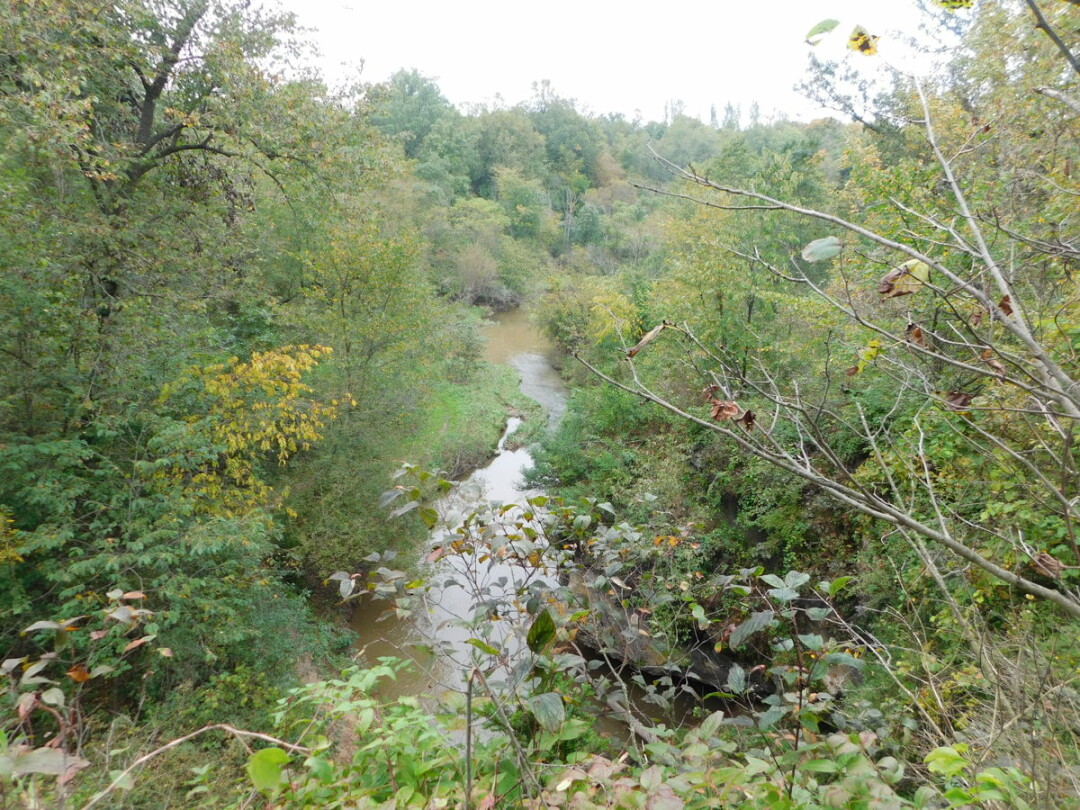
Trail descriptions: Moderate. There is a newly constructed section in the middle of the segment. It is well-groomed with wide paths there and a semi-groomed/narrow path on other sections. The Firth Lake Segment is located between County Road E/Baldy Mountain area and County Road CC west of Cornell. The eastern portion goes through some sketchy private land (wire is strung across one area of the trail and part of the hike goes through a cattle field). The entire trail is a bit more than 5 miles one way. Prepare for wet spots by wearing waterproof hiking boots. High tick area, so bring repellent.
Highlights: Part of the new section looks down on a beautiful creek and the trail winds down so that you can cross the creek on rocks.
Fee: None.
Distance/Directions/Parking: 60 minutes. From County Road E, go down 245th Avenue for three-fourths of a mile to a small parking spot and head east, or from County Road CC near Cornell, drive west on 250th Avenue to the Firth Lake parking spot (this road is very muddy in the spring) and hike either direction. The new section is to the west of this small lot. To begin the trail from the east, park in the small lot on County Road CC near the Chippewa River and hike west through private land until you reach the Chippewa County Forest. See map.
Brunet Island State Park
Where: Cornell, Chippewa County
Trail descriptions: Well-groomed. The short, narrow Pine Trail leads to the narrow Jean Brunet Nature Trail, an Easy 0.8-mile loop close to the water. The Nordic Trail is an Easy/Moderate wide trail that has loop options for up to 4.3 miles of trail.
Highlights: We always see deer on the Nordic Trail. The trails border inlets of the Chippewa and Fisher rivers.
Fee: State park pass.
Distance/Directions/Parking: 50 minutes. Take Highway 29 east to Cadott. Go north on Highway 27 to Cornell, go west on Highway 64 to Park Road to the park entrance. Or from Chippewa Falls, go north on Highway 178 to Highway 64, then go east to Park Road. Park at the headquarters building for the Nordic Trail and near the boat landing for the Pine/Jean Brunet trails. See map.
Lake Eleven Segment / Ice Age Trail
Where: Lublin, Taylor County
Trail descriptions: Moderate. Semi-groomed. Narrow path. The trail starts at a small parking lot off Highway 64 and heads north into the Chequamegon National Forest. Prepare for wet spots by wearing waterproof hiking boots. High tick area, so bring repellent.
Highlights: We observed beavers in a body of water not too far from the parking lot. About a mile into the trail, you pass between two bodies of water through a wet, overgrown section. Through-hikers will eventually reach the Lake Eleven campsite approximately 10 miles from the trailhead.
Fee: None.
Distance/Directions/Parking: 60 minutes. Take Highway 29 east to Thorp. Go north on Highway 73 to Highway 64. Turn right and drive approximately 4.5 miles. A small parking lot will be on the left. See map.
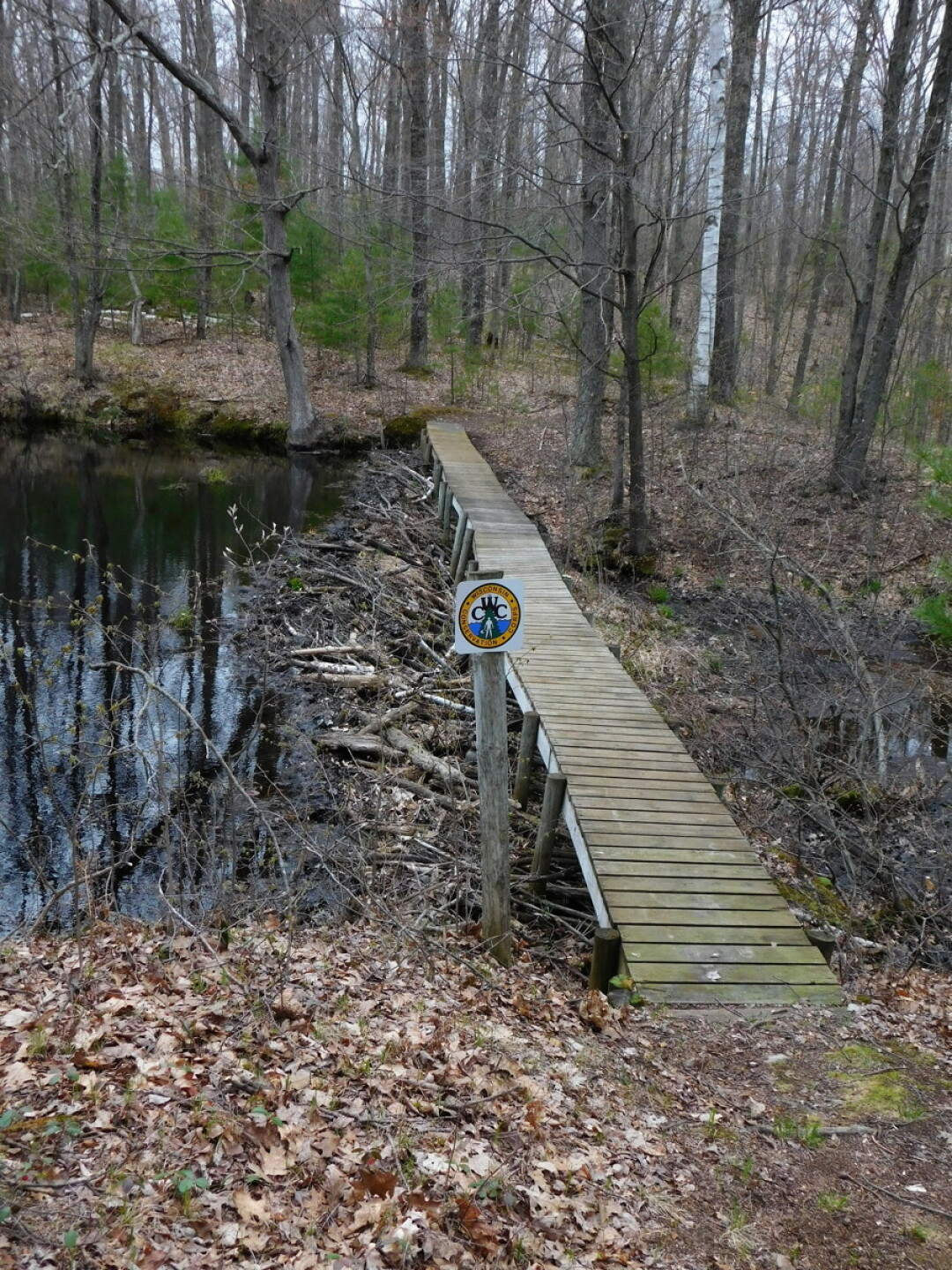
Hemlock Creek Segment / Ice Age Trail
Where: Birchwood, Rusk County
Trail descriptions: Moderate. Well/moderately-groomed. Narrow path. The southern end of the Hemlock Creek Segment loops with a county trail making a 2-mile hike. There is the option to continue north on the Ice Age Trail another 4 miles to Birchwood. The loop has several elevation changes. Prepare for wet spots by wearing waterproof hiking boots. High tick area, so bring repellent.
Highlight: The trail goes down to the Hemlock Creek about halfway through the loop. Cross a small footbridge, and climb a ridge to look down on where you just hiked. We’ve seen tundra swans on the creek.
Fee: None.
Distance/Directions/Parking: 70 minutes. Go north U.S. Highway 53 to Rice Lake exit 48 and head east through town. Turn right on 24th Avenue (this road turns into Cheese Factory Road) and drive to County Road F. Go left approximately 1.5 miles and look for good-sized parking area on the left. See map.
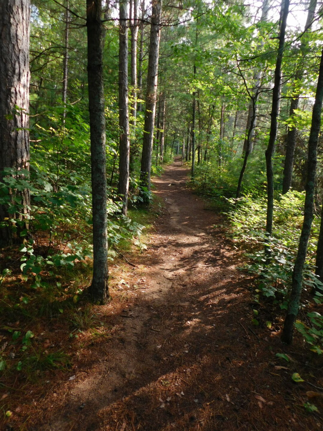
Trego Nature Trail
Where: Trego/Washburn County
Trail descriptions: Easy/Moderate. Well-groomed. Wide path. This 2.8-mile round-trip trail meanders through a pine/birch forest along the Namekagon River.
Highlight: There is a bench with a view of a bend in the Namekagon River at the beginning of the loop portion of the trail. The south and east ends of the loop have nice views of the Whalen Creek valley.
Fee: None.
Distance/Directions/Parking: 85 minutes. Go north on U.S. Highway 53 to Trego. Turn east on to Highway 63. Look for the parking area on the right not too far past the Namekagon River Visitor Center. A short drive into the woods will take you to a good-sized parking lot. See map.
HEADING WEST OF THE CHIPPEWA VALLEY
Nugget Lake County Park
Where: Plum City, Pierce County
Trail descriptions: Moderate. Well-groomed. Trail widths vary. There are nine short trails, ranging from 0.2 miles to 1.5 miles, which connect to make longer trail options. Some elevation changes give different views of Plum Creek, Rock Elm Creek, and an overview of Nugget Lake.
Highlights: Hike up a short climb to look at the creeks below, pass over several footbridges, view unique geological features (this is the site of a meteor impact) and people actually panning for gold.
Fee: $5 per vehicle per day.
Distance/Directions/Parking: 60 minutes. Take Interstate 94 west, exit south at Highway 128, then west on Highway 29, then south on County Road CC, then east on County Road HH. There are good-sized parking lots throughout the park. See map.
Willow River State Park
Where: Hudson, St. Croix County
Trail descriptions: Easy to Moderate to Hard. Well-groomed. Trail widths vary. There are more than a dozen trail options that attract many Wisconsin and Minnesota residents. Avoid the crowds taking the 0.4-mile Willow Falls Trail to the waterfalls and instead take the 2-mile (back and forth) Burkhardt Trail to the same destination.
Highlights: The Willow Falls attract many tourists who like to sit in the water. There are observation stands above the falls.
Fee: State park pass.
Distance/Directions/Parking: 65 minutes. Take Interstate 94 west to County Road U, head north and follow the signs to the state park. The parking lot for the Burkhardt Trail is on the north end of the state park off River Road. In the main park, there are ample parking lots. See map.
HEADING SOUTHEAST OF THE CHIPPEWA VALLEY
Levis Mound Trails
Where: Neillsville, Clark County
Trail descriptions: Moderate/Difficult. Well-groomed. Narrow paths. Hikers share the trails with mountain bikers. Some paths are tricky to walk on because of bike ramps and because they are laid out as switchbacks. There are several loop options through woods and up and around rock formations.
Highlights: The vistas from the Cliffhanger and Sidewinder trails are stunning and worth the climbs.
Fee: None.
Distance/Directions/Parking: 60 minutes. Take Interstate 94 south to Northfield exit. Head east on Highway 121 which becomes Highway 95. Turn left on County Road J and look for large parking lot on the left. See map.
Castle Mound Recreation Area
Where: Black River Falls
Trail Descriptions: Easy to Moderate. Well-groomed. Trail widths vary. A short trail goes to an overlook at the top of the mound that requires climbing a small metal ladder. A 1.5-mile trail circles around the base of the mound. This loop is Easy on the south side changing to Moderate on the north side.
Highlights: The view from the top of the mound looks over miles of scenery. Many interesting rock formations can be found around and leading up to the top of the mound.
Fee: None.
Distance/Directions/Parking: 55 minutes. Take Interstate 94 south to Black River Falls and exit to Highway 12. Go south through town on this road until you reach the entrance on the right. Ample parking. See map.
Black River State Forest
Where: Millston, Jackson County
Trail Descriptions: Moderate/Difficult. Well-groomed. Wide trails. There are several trail options between two sections of the state forest: the Wildcat Trails and the Smrekar Trails. Most of the trails consist of rolling up-and-down sections, sometimes with steep inclines.
Highlights: The 1.9-mile Ridge Trail on the far eastern end of the Smrekar trail section contains rock formations and a nice vista. There is also a cellar and well from an old farmstead in the middle of the Smrekar section. Other favorite trails include the 3.5-mile Wildcat loop and the 4-mile Central loop.
Fee: None.
Distance/Directions/Parking: Take Interstate 94 south to the Millston exit (County Road O), turn right away on North Settlement Road and drive north about 4 miles to the road for the Smrekar lot. Drive north another mile or so for the Wildcat lot. Ample parking at both locations. See map.
HEADING SOUTH OF THE CHIPPEWA VALLEY
Perrot State Park
Where: Trempealeau, Trempealeau County
Trail descriptions: The 2.5-mile Riverview Trail is an Easy trail that runs along the Mississippi River and Moderate/Difficult trails go up the 1-mile Brady’s Bluff trail (switchback trail and stairs on sides facing the river) and the 1.5-mile Perrot Ridge trail (straight up on one side). Well-groomed. Trail widths vary.
Highlights: The views of the Mississippi River valley from both bluffs are wonderful. We also enjoyed the sheer challenge of the Perrot Ride going up on the steep side.
Fee: State park pass.
Distance/Directions/Parking: 80 minutes. Take Highway 93 south of Eau Claire to Centerville where the road turns into Highway 35. Drive through the town of Trempealeau and look for park signs. Most trails start in the good-sized lot near park headquarters. See map.