

America: Messing with the Lines
At the intersection of three of my great loves—maps, fiction, and American history— sits this map. Neil Freeman, artist and urban planner, developed it in 2012 as part of a suggestion to redraw the state lines of America. No joke.
Freeman’s America consists of 50 states with equal population. He used 2010 census data, so each of the newly formed states has roughly 6,175,000 people within its borders. The result is that densely populated metropolises became their own state (or two) while areas where people are more spread out morphed into bigger states.
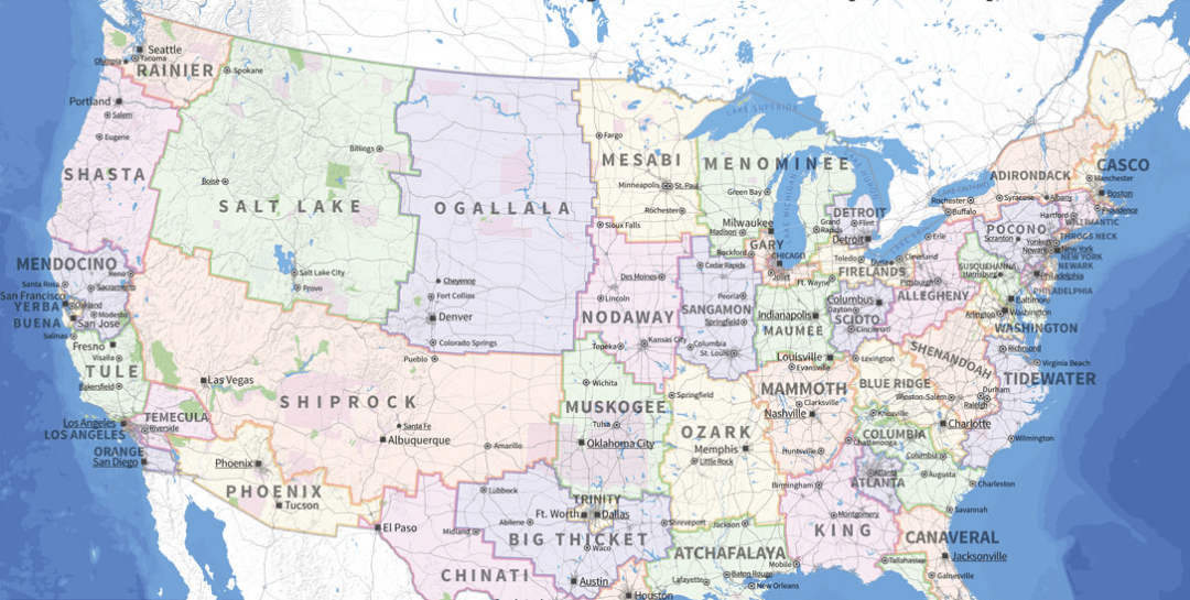
Freeman took some artistic liberties in naming new states — not one carries over its birth name — but I quite like them. The names are taken from important towns and cities, counties, mountain ranges, bodies of water, people, plants, ecological regions, or even songs.
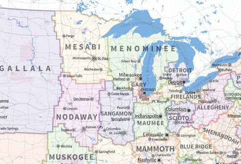
Let’s take a look at what became of Wisconsin ...
Eau Claire now sits on "Menominee’s" western border with Mesabi. Our new state has reclaimed the upper peninsula (about time) as well as absorbing about half of what was once Michigan. Menominee’s southwestern border moved down while giving up Racine County to the newly formed state of Gary (for the greater metropolis area of Chicago).
This map is a fun way to look at the American population a little differently. It’s an art project and shouldn’t be taken as a serious proposal, but state lines have changed before. Maybe its time to take back the upper peninsula, hand over a couple towns, and fly the "Menominee" state flag.
Maybe?
